Helping the World Through Science
Billions of people live unaware of a far-off USGS facility working every day to improve their lives
USGS Finds New Way to Measure Ocean Depth with Landsat
EROS scientists debut method in publication
Landsat's Exciting Future
Upcoming Landsat Next's trio of satellites will provide more frequent imagery in more detail
Landsat - A Pillar of Land Remote Sensing
Eyes on Earth
Eyes on Earth is a podcast on remote sensing, Earth observation, land change and science, brought to you by the USGS Earth Resources Observation and Science (EROS) Center.
Earth Resources Observation and Science (EROS) Center
At the USGS EROS Center, we study land change and produce land change data products used by researchers, resource managers, and policy makers across the nation and around the world. We also operate the Landsat satellite program with NASA, and maintain the largest civilian collection of images of the Earth’s land surface in existence, including tens of millions of satellite images.
Eyes on Earth

This episode of our remote sensing podcast describes how Landsat is used to map shoreline changes for the entire coastline of Australia.
Image of the Week
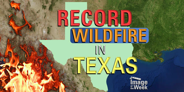
The Smokehouse Creek Fire burned more than 1,000,000 acres earlier this year, becoming a record-breaking event. Landsat shows the area before, during, and after the blaze—and how it is beginning to green up.
EROS Quick Links
Find frequently visited webpages below.