
Water Resources Mission Area
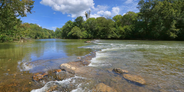
Water information is fundamental to national and local economic well-being, protection of life and property, and effective management of the Nation’s water resources. The USGS works with partners to monitor, assess, conduct targeted research, and deliver information on a wide range of water resources and conditions including streamflow, groundwater, water quality, and water use and availability.
Message from the Associate Director
Message from the Associate Director
Learn more about the Mission Area from the Associate Director for Water Resources.
Water Data for the Nation
Water Data for the Nation
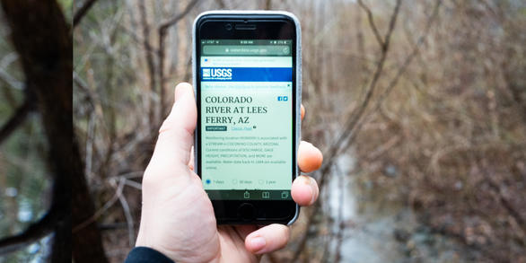
Water data collected at approximately 1.9 million sites across all 50 states.
News
Bill Werkheiser Selected as Associate Director for the Water Resources Mission Area
Bill Werkheiser Selected as Associate Director for the Water Resources Mission Area
Media Alert: USGS Dye-Tracing Study in Lake Fork Creek to Map Groundwater Flow
Media Alert: USGS Dye-Tracing Study in Lake Fork Creek to Map Groundwater Flow
USGS Scientists Deploy to New Mexico Fire to Enhance Water Monitoring
USGS Scientists Deploy to New Mexico Fire to Enhance Water Monitoring
Publications
Pesticide concentrations of surface water and suspended sediment in Yolo By-Pass and Cache Slough Complex, California, 2019–2021
Managed flow pulses in the north Sacramento-San Joaquin Delta are an adaptive management tool used in efforts to enhance food availability in delta smelt (Hypomesus transpacificus) habitat as part of the North Delta Food Subsidies Action. The California Department of Water Resources (DWR) monitors non-managed seasonal and local flow pulses and managed flow pulses from agricultural drainage or main
Assessment of nutrient load estimation approaches for small urban streams in Durham, North Carolina
This cooperative study between the City of Durham Public Works Department, Stormwater Division and U.S. Geological Survey evaluated whether alternate monitoring strategies that incorporated samples collected across an increased range of streamflows would improve nutrient load estimates for Ellerbe and Sandy Creeks, two small, highly urbanized streams in the City of Durham, North Carolina. Water-qu
External quality-assurance project report for the National Atmospheric Deposition Program National Trends Network and Mercury Deposition Network, 2021–22
The U.S. Geological Survey Precipitation Chemistry Quality Assurance project (PCQA) operated five distinct programs to provide external quality-assurance monitoring for the National Atmospheric Deposition Program (NADP) National Trends Network (NTN) and Mercury Deposition Network (MDN) during 2021–22. The NTN programs included (1) a field audit program to evaluate sample contamination and stabilit
Science
National Atmospheric Deposition Program (NADP)
The National Atmospheric Deposition Program (NADP) is a collaboration of atmospheric monitoring networks. The purpose of the networks is to collect data to evaluate air quality. Network data also inform science-based actions to protect human health and preserve ecosystems for current and future generations. The NADP National Trends Network (NTN) quantifies the concentration of eight major ions and...
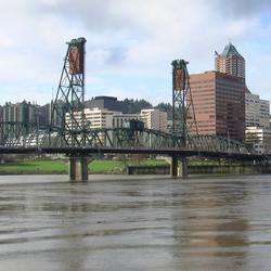
Integrated Water Science Basins: Willamette River
The Willamette River Basin reflects the conflicting water demands between humans and ecosystems—particularly salmon— and the challenge resource managers face throughout the Pacific Northwest.

U.S. Geological Survey Science Opportunities Related to the Nationally Relevant Study of Harmful Algal Blooms and Algal Toxins
In 2024, the U.S. Geological Survey (USGS) released a strategic vision document identifying harmful algal bloom (HAB) and algal toxin science gaps, while prioritizing research relevant to the mission, expertise, and capabilities of the USGS. The intention is for USGS and stakeholders to use this document as a starting point for planning, prioritizing, and designing future HAB and algal toxin...