
Groundwater and Streamflow Information
Surface-water Monitoring, Groundwater monitoring, and Flood Hazards
Surface-water Monitoring, Groundwater monitoring, and Flood Hazards
Water Use and Availability
Surface-water Modeling, Groundwater-flow Modeling, Hydrogeologic Characterization, Water Use, Flood Science, Climate Change
Surface-water Modeling, Groundwater-flow Modeling, Hydrogeologic Characterization, Water Use, Flood Science, Climate Change
Water Quality
Surface-water-quality Monitoring, Groundwater-quality Monitoring, Water-quality Modeling, Wetlands, Ecosystem Health
Surface-water-quality Monitoring, Groundwater-quality Monitoring, Water-quality Modeling, Wetlands, Ecosystem Health
Coastal Science
Beach and Barrier Dynamics, Flood Hazards, Nearshore Environmental Health, Tide and Wave Hydrodynamics, Wetlands, Climate and Land-Use Change
Beach and Barrier Dynamics, Flood Hazards, Nearshore Environmental Health, Tide and Wave Hydrodynamics, Wetlands, Climate and Land-Use Change
Ecosystem Health
Aquatic Community Health, Biogeochemical and Hydrologic Assessment, Climate Change, Ecological Assessment of Human and Natural Impacts
Aquatic Community Health, Biogeochemical and Hydrologic Assessment, Climate Change, Ecological Assessment of Human and Natural Impacts
New York Water Science Center
The New York Water Science Center will provide the hydrologic observations, research, and modeling needed for full integration of hydrogeologic, physiochemical, biological, and landscape processes across the freshwater to marine continuum.


NY WSC Quick Links
NY WSC Quick Links
Explore some of our most popular science topics, data, and tools
News
Advanced Quantitative Precipitation Information System Enhances Flood Prediction in San Francisco Bay Area
Advanced Quantitative Precipitation Information System Enhances Flood Prediction in San Francisco Bay Area
Native American Research Assistantship Student Learns USGS Water Science
Native American Research Assistantship Student Learns USGS Water Science
10th Anniversary of Hurricane Sandy
10th Anniversary of Hurricane Sandy
Publications
Low-flow statistics for selected streams in New York, excluding Long Island
The U.S. Geological Survey, in cooperation with the New York State Department of Environmental Conservation, updated low-streamflow statistics for New York, excluding Long Island and including hydrologically connected watersheds in bordering States, for the first time since 1972. Historical daily streamflow data for active and inactive gages were considered for this study with periods of record as
The Native American Research Assistantship Program—Building capacity for Indigenous water-resources monitoring
Intertribal networks for collecting and analyzing hydrologic and environmental data are growing. The U.S. Geological Survey can be a key partner with Tribal Nations in the further development of network capacity. A first step is the internship opportunity available through the partnership between the USGS and The Wildlife Society: The Native American Research Assistantship Program.
Isotopic evaluation of the National Water Model reveals missing agricultural irrigation contributions to streamflow across the western United States
The National Water Model (NWM) provides critical analyses and projections of streamflow that support water management decisions. However, the NWM performs poorly in lower-elevation rivers of the western United States (US). The accuracy of the NWM depends on the fidelity of the model inputs and the representation and calibration of model processes and water sources. To evaluate the NWM performance
Science

Cyanobacterial Harmful Algal Blooms in Central Park, New York
Cyanobacterial harmful algal blooms (cyanoHABs) can produce cyanotoxins that pose health risks to humans, pets, and wildlife that use freshwater lakes and ponds. While not often used for swimming or drinking water, human and animal contact with urban lakes can include boating, fishing, or use of shoreline walking paths. CyanoHABs are a persistent, annually recurring problem in several Central Park...
Development of a mapper-based Long Island Sound data and research portal (Clearinghouse)
In cooperation with the Long Island Sound Study (LISS) and U.S. Environmental Protection Agency (EPA), the U.S. Geological Survey (USGS) is creating a mapper-based clearinghouse that will provide information on sources of data available throughout the Long Island Sound (LIS) watershed and allow for real-time metadata output and integration into visualization and modeling tools developed through a...
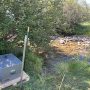
READI-Net: Providing Tools for the Early Detection and Management of Aquatic Invasive Species
The USGS has developed the Rapid environmental (e)DNA Assessment and Deployment Initiative & Network (READI-Net) to accelerate the implementation of environmental DNA (eDNA) analysis as a best practice for the early detection of aquatic biological threats. READI-Net provides tools and a strategy to collect and deliver early detection data for natural resource managers and public health protection...
By
Ecosystems Mission Area, Biological Threats and Invasive Species Research Program, Columbia Environmental Research Center, Eastern Ecological Science Center, Forest and Rangeland Ecosystem Science Center, New York Water Science Center, Northern Rocky Mountain Science Center, Upper Midwest Environmental Sciences Center, Wetland and Aquatic Research Center , Wyoming-Montana Water Science Center, Pacific Northwest Environmental DNA Laboratory