U.S. flag

An official website of the United States government

Natural Hazards Mission Area

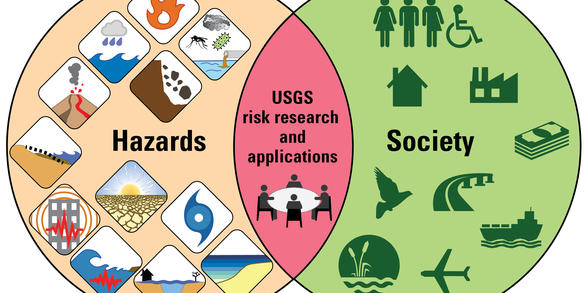
Every year in the United States, natural hazards threaten lives and livelihoods and result in billions of dollars in damage. We work with many partners to monitor, assess, and conduct targeted research on a wide range of natural hazards so that policymakers and the public have the understanding they need to enhance preparedness, response, and resilience.

News

Shifting Sand-Supply Dynamics in San Francisco Bay

Shifting Sand-Supply Dynamics in San Francisco Bay

In New Study, Scientists Identify Key Markers of the Anthropocene Epoch

In New Study, Scientists Identify Key Markers of the Anthropocene Epoch

Study Finds Seasonal Differences in Marshland Erosion in South San Francisco Bay

Study Finds Seasonal Differences in Marshland Erosion in South San Francisco Bay

Publications

Aftershock forecasting

Aftershocks can compound the impacts of a major earthquake, disrupting recovery efforts and potentially further damaging weakened buildings and infrastructure. Forecasts of the probability of aftershocks can therefore aid decision-making during earthquake response and recovery. Several countries issue authoritative aftershock forecasts. Most aftershock forecasts are based on simple statistical
Authors
Jeanne L. Hardebeck, Andrea L. Llenos, Andrew J. Michael, Morgan T. Page, Max Schneider, Nicholas van der Elst

Collision structures of the Prince William terrane and Chugach terrane docking along the Shumagin and Unimak convergent margins, Alaska, USA

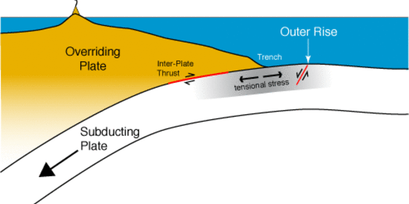
Western Alaska’s convergent margins are composed of tectonostratigraphic terranes. On land, terrane assembly is recognized along boundaries or sutures between neighboring geologic elements with distinctly different origins. In marine areas where rock outcrops are covered by sediment, recognizing terrane sutures is problematic. A fault in seismic dip line 5 of the ALEUT project has been interpreted
Authors
Roland E. von Huene, John J. Miller

Global variability of the composition and temperature at the 410-km discontinuity from receiver function analysis of dense arrays

Seismic boundaries caused by phase transitions between olivine polymorphs in Earth's mantle provide thermal and compositional markers that inform mantle dynamics. Seismic studies of the mantle transition zone often use either global averaging with sparse arrays or regional sampling from a single dense array. The intermediate approach of this study utilizes many densely spaced seismic arrays distri
Authors
Margaret Elizabeth Glasgow, Hankui K. Zhang, Brandon Schmandt, Wen-Yi Zhou, Jinchi Zhang

Science

June 28, 2024

Space Weather Events of June 28, 2024 - June 28, 16:00 Eastern time
link

June 28, 2024

Space Weather Events of June 28, 2024 - June 28, 16:00 Eastern time
Learn More

Landslide Basics

Landslides occur in all 50 states and territories and they affect lives, property, infrastructure, and the environment. Understanding when, where, and how landslides occur can help to reduce the risk of living with these natural hazards.
link

Landslide Basics

Landslides occur in all 50 states and territories and they affect lives, property, infrastructure, and the environment. Understanding when, where, and how landslides occur can help to reduce the risk of living with these natural hazards.
Learn More

Wildland Fire Science - Media Kit

The U.S. Geological Survey’s Wildland Fire Science Program produces information to identify the causes of wildfires, understand the impacts and benefits of both wildfires and prescribed fires, and help manage larger, catastrophic events.
link

Wildland Fire Science - Media Kit

The U.S. Geological Survey’s Wildland Fire Science Program produces information to identify the causes of wildfires, understand the impacts and benefits of both wildfires and prescribed fires, and help manage larger, catastrophic events.
Learn More