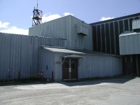
Clear AFS, AK
Tracking Radar
 The tracking radar, commonly referred to as the tracker, was housed in a 140 foot diameter radome on top of building 102. To get there, we have to go upstairs from the MIP area, through the transmitter area, and up a winding staircase into the tracker radome. The radar dish had a span of 85 feet, and it could rotate and elevate to track any object above the horizon at Clear to a range of 3,000 miles.
The primary purpose of the tracker was attack assessment. The tracker's data, when analyzed by the MIP, provided a fine-tuning of Launch and Predicted Impact (L&PI) data to be used by the Missile Warning Center (MWC). The tracker could also be used to replace a detection radar beam if a detection radar was non-operational. This allowed Clear to stay "green" for missile warning even if it lost a portion of its detection radar coverage.
On a day-to-day basis, however, the tracker was used to track satellites for the Space Control Center (SCC). Its data allowed the SCC to keep manned objects like the Space Shuttle and Mir out of harms way by tracking all low-earth orbiting objects. Finally, the tracker could also be used to cover for other missile warning sites like Thule, Cavalier, and Beale when they were undergoing maintenance. This allowed the MWC to keep the highest possible missile warning time.
Below is a composite picture of the tracker inside the radome. When operational, the 85 foot dish could zip around inside the radome like an amusement-park ride.
|
NEWSLETTER
|
| Join the GlobalSecurity.org mailing list |
|
|
|

