I stumbled across this cavern in Minecraft. It's a naturally hollow mountain. I should do something with it later...

Click image to view full.
See the rest of “Hollow Mountain”»I stumbled across this cavern in Minecraft. It's a naturally hollow mountain. I should do something with it later...
August 18th I rode my bicycle up to Table Rock. It's a viewpoint that looks out over Boise Idaho. Click an image to view full.
Here's what it looks like up on Table Rock. The heat that day made getting up there tougher than it should have been.

Zoomed in on Boise, if you look a bit you can see the dome of the Capitol Building.

There's a path that goes down and around the cliff face. Every square inch of that cliff is covered with graffiti. Not just spray-painted, but carved into the soft rock.

There's also a cave under Table Rock.

Because you can see most of Boise from table Rock, it's a good place for cell antennas. Ironically, I had a rather poor cell signal up there. Must have been all the interference.

Also something you can see from most of Boise is the giant cross they light up at night. I don't know who owns the land, but it just seems wrong... And why are the other religions neglected? I demand a giant Flying Spaghetti Monster to be lit up at night on Table Rock, that would be sweet!

Scenery from an old logging road named Brown Mountain Road. These were taken June 9th, 2010.


My dad and I hiked up to Perseverance Lake yesterday (Sep. 25th), then on up to the top of Ward Mountain. The trail continues beyond where we stopped. It goes across Minerva Mountain, but the boardwalk ended at the top of Ward Mountain and got really mucky. Click an image to view full.
Here's Perseverance Lake. It's bigger than what you can see in the photo.
Here's a shot of the lake's shoreline.
This is what the trail's boardwalk looks like. Most of the trail is like this, through varying densities of trees.
Here's the view from the top of Ward Mountain. That's the old pulp mill you can see, it has been shut down for years.
Looking in a different direction, you can see Connel Lake (the big one), and just up and to the right of it you can see Talbot Lake.
A while back (May 13th) I went part of the way up Deer Mountain until the snow became prohibitive. I took some pictures that day along the way and shared them here. Yesterday (September 6th, 2008) my dad and I went to the top. So here's a few pictures from 3,001 feet of elevation here in Ketchikan, Alaska. Click an image to view full.
This is a true bird's-eye view of my home town; Ketchikan, Alaska. You can see the top of Deer Mountain from about everywhere in town, so you can see about the entire town from the top.
This is the view off to the left of the previous picture. This is South of town and the Alaska Native town of Saxman. Off in the distance you can barely make out Metlakatla if you view the full-size image.
This is the very top of Deer Mountain, with an official height of 3,001 feet above sea level.
Looking across the mountain ridge to other mountains. You can see, there's still some snow up here. I really like how the alpine looks up here.
This is down off the top of the mountain, right in the alpine you can see in the previous picture.
On Monday I left Revillagigedo Island (the island Ketchikan, Alaska is on) for a few hours. I went over to Gravina Island with my bicycle, where our airport is. Yes, this is the island the infamous "Bridge to Nowhere" was suppose to be built to. I'll talk about that in a later post, this post is photos I took while over there. Click an image to view full.
On the ferry, heading over to the airport. By boat is the only way to get over there, costs $5.00 per passenger (round trip), $6.00 per vehicle (one way). Lucky for me, my bike went for free.
Here's where the tunnel is/will be that passes under the airport runway. It's all part of the construction of the "Road to Nowhere" (again, I'll talk about it later). For now, they have a pilot car that escorts traffic across the runway. I had to put my bicycle in the back of the pilot car and ride in the passenger seat to get across (both ways).
This is right on the other side of the runway, the road makes a "T". They wouldn't let me go very far when I turned left here.
That little bridge is all the further I was allowed to go. There's heavy construction ahead. They told me the dump truck drivers drive like maniacs, and it was unsafe for me to ride any further.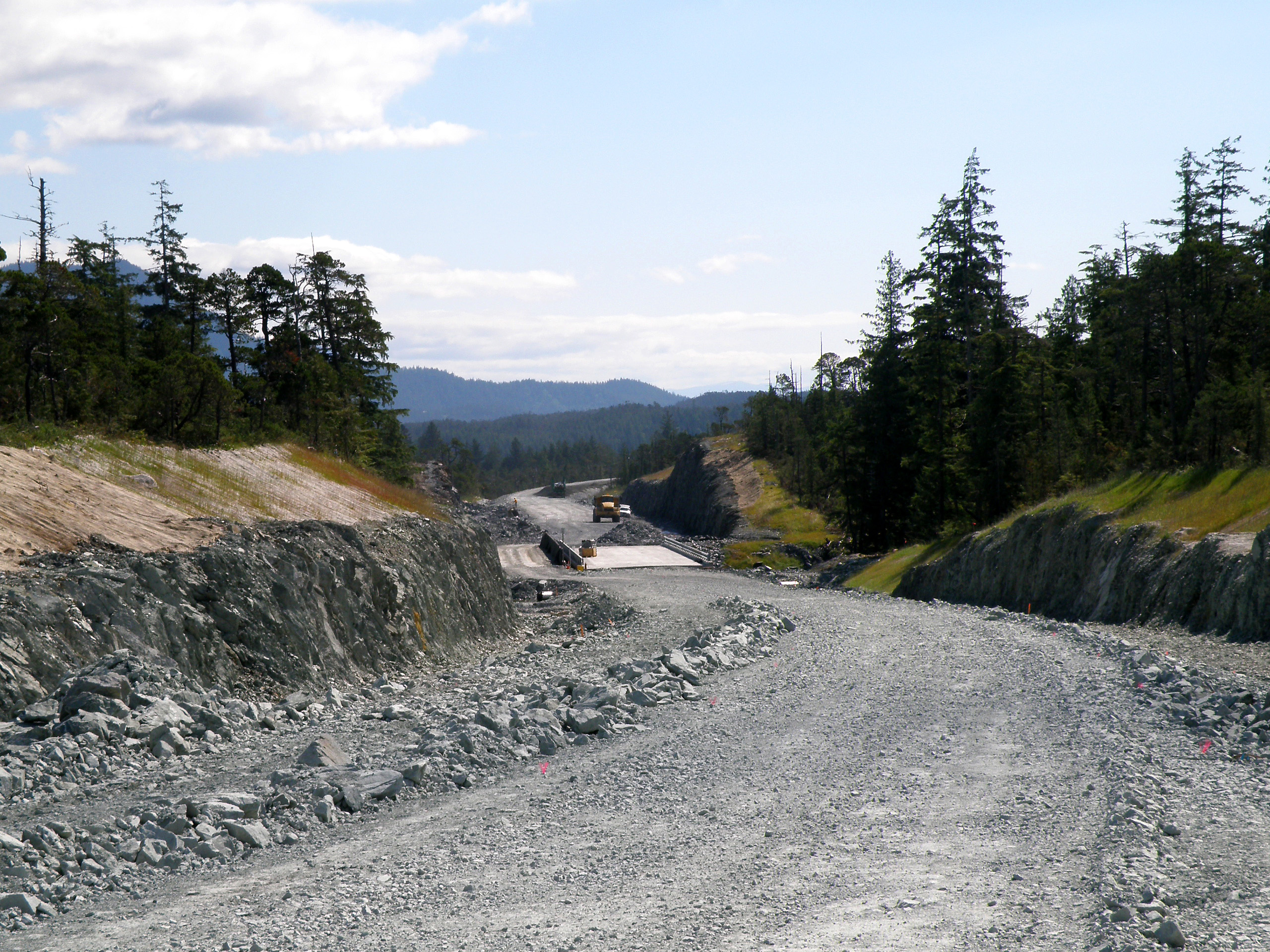
So I turned around and went on the road to the right of the "T" intersection. You can see they have a lot of supplies lined up along the road.
I stopped to take a picture of this pond with Ketchikan in the background.
I went up a random side road. I didn't go very far. They dig across old logging roads they no longer use to allow water to drain from one side to the other so it doesn't wash out the road, in case they want to use it again. It also makes it tough for vehicles of any kind to continue on the road. This is the road that I found the bear crap on, by-the-way.
Here's what the road looks like that I've been riding on. Notice all the relatively flat land over here?
My bicycle, with quite the backdrop.
I went up another random logging road, this one took me up a mountain a little ways. It eventually got too rough to comfortably continue. Besides, it was cutting away from the water and going towards the interior of Gravina Island. This is looking back across to Ketchikan. It was a little dusty that day, as you can tell from the picture.
Approaching the tunnel again, opposite side the other picture was. You can see how Ketchikan is built on the side of the mountains.
Here, I'm on the ferry heading back to Revillagigedo Island (Ketchikan). I tried to catch the beautiful green left in the wake of the other ferry, but the camera didn't pick up on the color too well. That cruise ship is the Diamond Princess.
EDIT: Here's that later post where I talk about the bridge.
I may not have 1,000 posts yet (this one happens to be number 188), but I still have reflections of my own from time-to-time.
This one is a reflection off of Ward Lake, taken on May 16th, 2008.
Here's a few pictures I took on the 19th. Click an image to view full.
I caught a bee in this flower.
Here's a flower of the same type, without a bee.
Here, you can see an eagle nest in the dead tree in the center (it's still in use). There's also a cell phone antenna on the highest mountain peak in the picture.
This one I played around in photoshop a bit to bring out the colors.
Once again, no jury duty. The trial has been canceled. Now I've got to call Monday to see if there's a trial on Tuesday.
Today I did some hill climbing with my bicycle. Keep in mind it's only a 5 speed, not one of those fancy 24 speed mountain bikes. Believe me, this town has its share of hills. Much of it is built on the side of a mountain.
When I got home I noticed I had run over a thumbtack. So now my front tire is flat. I'm none too happy about that. I had just bought lights for it so I could do some night riding. (Now I have an image of that car from Knight Rider in my head.) Now I'll have to wait until I fix the tire. My tires are old and cracked anyway, so I might just replace them.
I downloaded Firefox 3, and helped their attempt at setting a world record. I haven't installed it yet, however. What's the previous record for most downloads in one day? Turns out there isn't one. No-one's bothered to formally claim the record. Their target was 5 million, and (at the time I'm writing this) the day isn't quite over yet and they already have 5,144,640. So they've made their goal.
Yesterday I went for a hike on the Deer Mountain trail. I knew I wouldn't get to the top, because there's 50 or so feet of snow up there. Deer Mountain is 3,001 feet tall, and I'd say I made it to about 1,800 feet (just a guess) before the snow was prohibitive. Click an image to view full.
Here's a picture of the mountain.
Half a mile into the trail, elevation 980ft.
Not much past the previous picture, here's the first significant patch of snow.
And from there on there were patches across the trail in some places.
3/4 mile into the trail, elevation 1,240.
1 mile into the trail, elevation 1,500.
There's a viewpoint right past the 1 mile sign. There were 5 elderly people up there at this viewpoint. Two of them were talking on cell phones, while two others (presumably their wives) were worried about roaming charges. Finally one of the ones on the phone said they weren't roaming. It just struck me as funny. Here I am, 1,500 feet high on a mountain, had to walk through snow to get here... And I find a bunch of old people on cell phones. Here's a picture from the viewpoint.
I zoomed in as far as I could (20x) on Metlakatla from the viewpoint.
A bit past the viewpoint, the trek gets more challenging.
I looked directly across to another mountainside at my elevation, to find it covered in snow. No doubt my side looks similar.
This is as far as I got. Keep in mind, I was only wearing slip-on shoes. I was starting to fall through the snow patches, so I turned around.
I took a picture of part of town I could see from here, then descended back down the mountain. Looks like a junkyard or something on the South end of town.
These are websites, specific pages, or blog entries of interest I have come across; be it random or otherwise.
Note: This widget will not appear in individual post pages.
 Some Rights Reserved; Cody Durkin. Please include a link to http://www.mastermarf.com.