CORONA Summary
CORONA is the name for the first operational space photo reconnaissance satellite. President Dwight David Eisenhower approved the project in Febuary 1958. The project was conceived to take pictures in space of the Soviet Bloc countries and de-orbit the photographic film for processing and exploitation. The Discoverer program was used as a cover for the development, testing and operation of CORONA.
President Clinton signed an Executive Order on 22 February 1995, directing the declassification of intelligence imagery acquired by the first generation of U.S. photo-reconnaissance satellites; the systems code-named CORONA, ARGON and LANYARD. The order provides for the declassification of more than 860,000 images of the Earth's surface, collected between 1960 and 1972.
Early imagery collections were driven, in part, by the need to confirm purported developments in Soviet strategic missile capabilities. Worldwide photographic coverage was also used to produce maps and charts for the Department of Defense and other U.S. Government mapping programs. A speech made on 24 February 1995 by Admiral William O. Studeman, Acting Director of Central Intelligence Agency (CIA), recounts some of the important achievements of the historical satellite imagery reconnaissance programs.
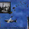
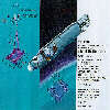
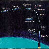
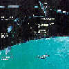
The Corona vehicle was launched by a THOR booster and used the AGENA spacecraft as the upper stage. While in orbit, Corona took photographs with a constant rotating stereo panoramic camera system and loaded the exposed photographic film into recovery vehicles. The vehicles were de-orbited and recovered by Air Force C-119 aircraft while floating to earth on a parachute.
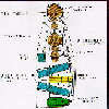

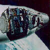
The major components of the CORONA camera system are shown in detailed drawings and photographs of the systems used.

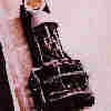
Side and Top View of the CORONA camera and recovery system as seen on display at the Central Intelligence Agency. The camera is currently in storage at the National Air and Space Museum being readied for display in late 1996.
CORONA spacecraft were built from 1959-72 by Lockheed Space Systems under Central Intelligence Agency and U.S. Air Force contracts spanning 145 launches that provided intelligence the government has called "virtually immeasurable."
CORONA's payload was a vertical-looking, reciprocating, 70-degree panoramic camera developed by Itek that exposed Eastman Kodak film by scanning at right angles to the line of flight. Resolution in early flight years was in the range of 35 to 40 feet. By 1972, CORONA delivered resolutions of six to 10 feet, routinely. In the 1970s, flights could remain on orbit for 19 days, provide accurate attitude, position, and mapping information, and return coverage of 8,400,000 nm2 per mission.
After 13 years, the CORONA program ended with a launch on May 25, 1972. Recently released National Intelligence Estimates reveal that CORONA:
- Imaged all Soviet medium-range, intermediate-range and ICBM complexes
- Imaged each Soviet submarine class from deployment to operational bases
- Provided inventories of Soviet bombers and fighters
- Revealed the presence of Soviet missiles in Egypt protecting the Suez Canal
- Identified Soviet nuclear assistance to the People's Republic of China
- Monitored the SALT I treaty
- Uncovered the Soviet ABM program and sites (GALOSH, HEN HOUSE, etc.)
- Identified Soviet atomic weapon storage installations
- Identified People's Republic of China missile launching sites
- Determined precise locations of Soviet air defense missile batteries
- Observed construction and deployment of the Soviet ocean surface fleet
- Identified Soviet command and control installations and networks
- Provided mapping for Strategic Air Command targeting and bomber routes
- Identified the Plesetsk Missile Test Range, north of Moscow

The intelligence community used the designators KH-1, KH-2, KH-3, KH-4, KH-4A, and KH-4B for the CORONA systems. The ARGON systems were designated KH-5 and the LANYARD systems KH-6. These KH (Keyhole) designators are used throughout this guide to describe system characteristics and accomplishments. Mission numbers were a principal means for indexing the reconnaissance imagery and associated collateral data. The correlation of mission numbers to KH designators for missions that acquired film is given in the following table:
CORONA, ARGON and LANYARD Systems
| KH Designator | System | Successful Mission Numbers | Period of Operations | Amount of Film (ft) | No. of Primary Camera Frames |
|---|---|---|---|---|---|
| KH1 | CORONA | 9009 | June 1959 - September 1960 | 3,548 | 1,432 |
| KH2 | CORONA | 9013, 9017, 9019 | October 1960 - October 1961 | 17,949 | 7,246 |
| KH3 | CORONA | 9022, 9023, 9025, 9028, 9029 | August 1962 - January 1962 | 24,676 | 9,918 |
| KH4 | CORONA | 9031, 9032, 9035, 9037, 9038, 9039, 9040, 9041, 9043, 9044, 9045, 9047, 9048, 9050, 9051, 9053, 9054, 9056, 9057, 9062 | February 1962 - December 1963 | 239,299 | 101,743 |
| KH4 | CORONA | 1001, 1002, 1004, 1006-1031, 1033-1052 | August 1963 - October 1969 | 1,293,025 | 517,688 |
| KH4 | CORONA | 1101-1112, 1114-1117 | September 1967 - May 1972 | *505,970 | 188,526 |
| KH5 | ARGON | 9034A, 9046A, 9058A, 9059A, 9065A, 9066A | February 1961 - August 1964 | 22,503 | 38,578 |
| KH6 | LANYARD | 8003 | March 1963 - July 1963 | 2,251 | 910 |
| Total | 2,109,221 | 866,041 |
Temporal Coverage
The first successful photographs from space were taken on 18 August 1960 by the KH-1 system and the last of the imagery of this collection was acquired on 31 May 1972 by the KH-4B system.
The CORONA imagery was acquired by satellite-borne camera systems. The satellites were designed to deorbit a film capsule (referred to as a "bucket")from space with mid-air recovery of the returning capsule by a specially equipped aircraft. Early systems operated with a single bucket, while later systems were configured with two buckets; the KH-4A was the first satellite with multiple film buckets.
Early systems (KH-1, KH-2, KH-3 and KH-6) carried a single panoramic camera, or a single frame camera (KH-5), while the later systems (KH-4, KH-4A, and KH-4B) carried two panoramic cameras with 30 degrees separation angle. For KH-4, KH-4A,and KH-4B missions, the two cameras are referred to as fore (for forward looking) and aft (for rear looking). The KH-6 camera was programmed to tilt between fore and aft to cover the same land area twice during a photographic pass and thus to acquire stereo coverage.
The spatial and temporal characteristics of the declassified historical satellite imagery are given here according to KH designator.
System |
KH1-4* | KH4A | KH4B | KH5 | KH6 |
|---|---|---|---|---|---|
| Camera Type |
Panoramic | Panoramic | Panoramic | Frame | Panoramic |
| Film Width |
70 mm | 70 mm | 70 mm | 5 in | 5 in |
| Approx. Frame Format (in. x in.) |
2.18 x 29.8 | 2.18 x 29.8 | 2.18 x 29.8 | 4.5 x 4.5 | 4.5 x 25. |
| Focal Length (in.) |
24 | 24 | 24 | 3 | 66 |
| Best Resolution of Film (approx lines/mm) |
50100 | 120 | 160 | 30 | 160 |
Enlargement Capability |
Less than 10 times | 16 times | 16 times | 8 times | 16 times |
| Best Ground Resolution (approx.) |
25 ft. | 9 ft. | 6 ft. | 460 ft. | 6 ft. |
| Nominal System Altitude (nautical miles) |
90250 | 100 | 81 | 174 | 93 |
| Nominal Photo Scale on Film |
1:275,000 to 1:760,000 | 1:305,000 | 1:247,500 | 1:4,250,000 | 1:100,000 |
| Nominal Ground Coverage per Image Frame (miles) |
9.5 X 130 to 26 X 360 | 10.6 X 144 | 8.6 X 117 | 300 X 300 | 7.5 X 40 |
| Nominal Ground Sample Distance of GLIS** Browse Image (ft/pixel) |
530 | 530 | 430 | 4000 | 180 |
*The KH-1, KH-2, KH-3, and KH-4 are grouped together for describing camera-related features. The KH-4 designator was sometimes used by the Intelligence Community to refer to the entire group.
** GLIS - Global Land Information System
Sources and Resources
- Early Satellites in US Intelligence Remarks by Admiral William O. Studeman Acting Director of Central Intelligence at the Signing of the Executive Order Declassifying Early Satellite Imagery 2/24/95
- CORONA and the Intelligence Community - Declassification's Great Leap Forward Kevin C. Ruffner Studies in Intelligence 1996 Vol. 39, No. 5
- Corona Symposium, thomasona@netcom.com (Allen Thomson), 1995/05/25.
- New article on CORONA history (Allen Thomson) 1997/02/05
- Re: New article on CORONA history (Steven J Forsberg ) 1997/02/06
- THE CORONA SATELLITE NRO Factsheet
- CORONA PROGRAM PROFILE LockMart Factsheet 95-54 May, 1995
- CORONA INTELLIGENCE SATELLITES BUILT BY LOCKHEED MARTIN LockMart Factsheet May, 1995
- Declassified Intelligence Satellite Photographs
- An Illustration of the Use of Declassified Corona, Lanyard, and Argon Photography in Environmental Studies Dennis Hetrick, Danielle Ehlen, and Paul Seevers, USGS EROS Data Center
|
NEWSLETTER
|
| Join the GlobalSecurity.org mailing list |
|
|
|


