| NEWS | SPORT | WEATHER | WORLD SERVICE | A-Z INDEX | ||||||||
|
| You are in: Technology | |||||||||||||||||||||||||||||||||||||||||||||||||||||||||||||||||||||||||||||||||||||||||||||||||||||||||||||||||||||||||||||||||||||||||||||||||||||||
|
Thursday, 3 October, 2002, 07:41 GMT 08:41 UK
Satellites harnessed for progress

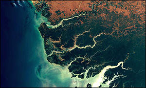
Satellite imagery can reveal coastal erosion
Geographical Information Systems (GIS) use information stored in databases and place it on a map, making it clear to read and understand. It is difficult to see a pattern by just looking at a list of street names where accidents have happened. But put the same information on a map you can see exactly where the dangerous junctions are. Aid to development GIS is arousing the interest of a growing number of students from developing countries.
"I think GIS will play a very important role in the developing world where I come from," he said. "You can use GIS in a lot of projects, such as sustainable development projects. "If you want to optimally locate the provision of new services, things like schools, you need to look at the distribution of people in your country and then decide where to put the schools so that people can easily access those services," he explained. "This will in turn enhance the development of the whole country." Setting priorities Using GIS, urban planners can identify which areas need which facilities the most, as it is no good building a new school if there are few children living in the area.
The technology makes use of the huge array of satellites orbiting the Earth which take digital images of the planet. Changes to the planet's surface can be tracked using the satellites and can be used to map data collected on the surface. These data are often taken from more traditional sources, such as medical records, for example. Breeding ground "It can be used in health," said Anthony Tuffour from Ghana, who has just completed his masters degree at University College in London. "I was talking to a friend of mine who is doing a project in Ghana and he is using GIS to map out malaria incidences in Ghana and then tries to establish the cause-effect."
"If you see that the larvae are breeding in stagnant waters and then people are dying of malaria, then definitely in spatial terms it tells you that the cause of that death is the stagnant waters breeding mosquitoes," said Mr Tuffour. Leapfrog ahead You need a powerful computer to get the most out of a GIS system, something which could be a problem in developing countries. But S Sridhar, Managing Director of Indian GIS company Magnasoft, argues that developing countries may even have an advantage when it comes to the latest technologies. "We were very slow in getting into telephony. It took a long time to get a telephone line," he said. "A few years ago it used to take hours to walk to a telephone line. Today, you've got mobile devices in almost every village in India. "Thanks to liberalisation and the opening up of the Indian economy, a lot of international telephone technologies have come," he explained. "In a way we have definitely leapfrogged and we're into much more recent technology. It's the same in the computer industry." You can hear more about the use of GIS on the BBC World Service programme Go Digital.
|
See also:
03 Oct 01 | Science/Nature
22 Sep 00 | Health
15 Jul 99 | Africa
28 Mar 02 | Science/Nature
Internet links:
The BBC is not responsible for the content of external internet sites Top Technology stories now:
Links to more Technology stories are at the foot of the page.
|
|||||||||||||||||||||||||||||||||||||||||||||||||||||||||||||||||||||||||||||||||||||||||||||||||||||||||||||||||||||||||||||||||||||||||||||||||||||
|
Links to more Technology stories |
 |
|
|||
| ----------------------------------------------------------------------------------
To BBC Sport>> | To BBC Weather>> | To BBC World Service>> ---------------------------------------------------------------------------------- © MMIII | News Sources | Privacy |