
Launaguet
Launaguet | |
|---|---|
 Château de Launaguet - Current City Hall. | |
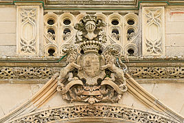
 Coat of arms | |
Location of Launaguet  | |
 Launaguet  Launaguet | |
| Coordinates: 43°40′30″N 1°27′28″E / 43.675°N 1.4578°E | |
| Country | France |
| Region | Occitania |
| Department | Haute-Garonne |
| Arrondissement | Toulouse |
| Canton | Toulouse-8 |
| Intercommunality | Toulouse Métropole |
| Government | |
| • Mayor (2020–2026) | Michel Rougé[1] |
| Area 1 | 7.02 km2 (2.71 sq mi) |
| Population (2021)[2] | 9,260 |
| • Density | 1,300/km2 (3,400/sq mi) |
| Time zone | UTC+01:00 (CET) |
| • Summer (DST) | UTC+02:00 (CEST) |
| INSEE/Postal code | 31282 /31140 |
| Elevation | 126–203 m (413–666 ft) (avg. 135 m or 443 ft) |
| 1 French Land Register data, which excludes lakes, ponds, glaciers > 1 km2 (0.386 sq mi or 247 acres) and river estuaries. | |
Launaguet (French pronunciation: [lonaɡɛ]; Occitan: Launaguet) is a commune in the Haute-Garonne department in southwestern France.
Population
The inhabitants of the commune are known as Launaguetois or Launaguetoises in French.
| Year | Pop. | ±% p.a. |
|---|---|---|
| 1968 | 1,407 | — |
| 1975 | 2,771 | +10.17% |
| 1982 | 2,842 | +0.36% |
| 1990 | 3,768 | +3.59% |
| 1999 | 5,086 | +3.39% |
| 2007 | 6,926 | +3.94% |
| 2012 | 7,469 | +1.52% |
| 2017 | 8,880 | +3.52% |
| 2018 | 8,942 | +0.70% |
| Source: INSEE[3] | ||
Sights
-
 Chateau facade
 -
 Chateau entrance
 -
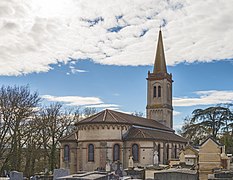 Saint Barthélemy apse
 -
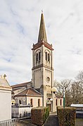 Bell tower


Twin towns
Launaguet is twinned with:
See also
References
- ^ "Répertoire national des élus: les maires" (in French). data.gouv.fr, Plateforme ouverte des données publiques françaises. 13 September 2022.
- ^ "Populations légales 2021" (in French). The National Institute of Statistics and Economic Studies. 28 December 2023.
- ^ Population en historique depuis 1968, INSEE
Wikimedia Commons has media related to Launaguet.
| Authority control databases: National |
|---|
This Haute-Garonne geographical article is a stub. You can help Wikipedia by expanding it. |