
Garidech
Garidech | |
|---|---|
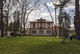
 A general view of Garidech | |
 Coat of arms | |
Location of Garidech  | |
 Garidech  Garidech | |
| Coordinates: 43°42′32″N 1°33′42″E / 43.7089°N 1.5617°E | |
| Country | France |
| Region | Occitania |
| Department | Haute-Garonne |
| Arrondissement | Toulouse |
| Canton | Pechbonnieu |
| Intercommunality | Coteaux du Girou |
| Government | |
| • Mayor (2020–2026) | Christian Ciercóles[1] |
| Area 1 | 7.11 km2 (2.75 sq mi) |
| Population (2021)[2] | 1,909 |
| • Density | 270/km2 (700/sq mi) |
| Time zone | UTC+01:00 (CET) |
| • Summer (DST) | UTC+02:00 (CEST) |
| INSEE/Postal code | 31212 /31380 |
| Elevation | 132–214 m (433–702 ft) (avg. 190 m or 620 ft) |
| 1 French Land Register data, which excludes lakes, ponds, glaciers > 1 km2 (0.386 sq mi or 247 acres) and river estuaries. | |
Garidech (French pronunciation: [ɡaʁidɛʃ]; Occitan: Garidèit) is a commune in the Haute-Garonne department in southwestern France.
Population
| Year | Pop. | ±% |
|---|---|---|
| 1962 | 305 | — |
| 1968 | 318 | +4.3% |
| 1975 | 380 | +19.5% |
| 1982 | 520 | +36.8% |
| 1990 | 698 | +34.2% |
| 1999 | 954 | +36.7% |
| 2006 | 1,498 | +57.0% |
| 2008 | 1,554 | +3.7% |
| 2011 | 1,610 | +3.6% |
| 2015 | 1,741 | +8.1% |
| 2016 | 1,756 | +0.9% |
| 2018 | 1,851 | +5.4% |
The inhabitants of the commune are called Garidéchois.
Transport
Monuments
-
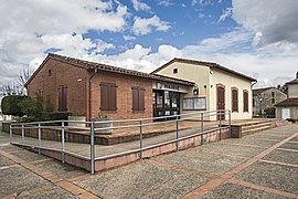 Town hall
 -
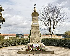 War memorial
 -
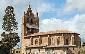 Church Saint-Jean-Baptiste
 -
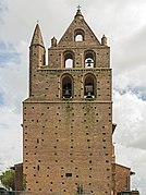 Bel gable
 -
 Primary school


See also
References
- ^ "Répertoire national des élus: les maires". data.gouv.fr, Plateforme ouverte des données publiques françaises (in French). 2 December 2020.
- ^ "Populations légales 2021" (in French). The National Institute of Statistics and Economic Studies. 28 December 2023.
Wikimedia Commons has media related to Garidech.
| Authority control databases: National |
|---|
This Haute-Garonne geographical article is a stub. You can help Wikipedia by expanding it. |