
Castillon-de-Larboust
Castillon-de-Larboust | |
|---|---|
 A general view of Castillon-de-Larboust | |
Location of Castillon-de-Larboust  | |
 Castillon-de-Larboust  Castillon-de-Larboust | |
| Coordinates: 42°48′25″N 0°32′05″E / 42.8069°N 0.5347°E | |
| Country | France |
| Region | Occitania |
| Department | Haute-Garonne |
| Arrondissement | Saint-Gaudens |
| Canton | Bagnères-de-Luchon |
| Government | |
| • Mayor (2020–2026) | Philippe Crampe[1] |
| Area 1 | 20.67 km2 (7.98 sq mi) |
| Population (2021)[2] | 79 |
| • Density | 3.8/km2 (9.9/sq mi) |
| Time zone | UTC+01:00 (CET) |
| • Summer (DST) | UTC+02:00 (CEST) |
| INSEE/Postal code | 31123 /31110 |
| Elevation | 877–3,110 m (2,877–10,203 ft) (avg. 1,000 m or 3,300 ft) |
| 1 French Land Register data, which excludes lakes, ponds, glaciers > 1 km2 (0.386 sq mi or 247 acres) and river estuaries. | |
Castillon-de-Larboust is a commune in the Haute-Garonne department in southwestern France.
-
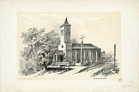 Church in 1840,
by Eugène de Malbos. -
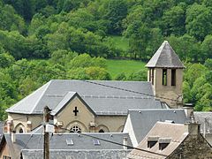 Church in 2010.
 -
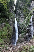 La cascade d'Enfer.
 -
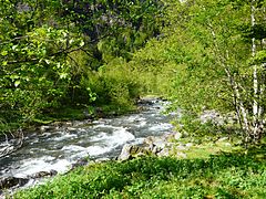 La vallée du Lis.
 -
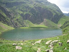 The Green lake.


Population
| Year | Pop. | ±% |
|---|---|---|
| 1962 | 79 | — |
| 1968 | 67 | −15.2% |
| 1975 | 63 | −6.0% |
| 1982 | 65 | +3.2% |
| 1990 | 86 | +32.3% |
| 1999 | 83 | −3.5% |
| 2008 | 65 | −21.7% |
See also
References
- ^ "Répertoire national des élus: les maires". data.gouv.fr, Plateforme ouverte des données publiques françaises (in French). 9 August 2021.
- ^ "Populations légales 2021" (in French). The National Institute of Statistics and Economic Studies. 28 December 2023.
Wikimedia Commons has media related to Castillon-de-Larboust.
| Authority control databases: National |
|---|
This Haute-Garonne geographical article is a stub. You can help Wikipedia by expanding it. |