
Bazus
Bazus | |
|---|---|
 A view within Bazus | |
 Coat of arms | |
Location of Bazus  | |
 Bazus  Bazus | |
| Coordinates: 43°44′11″N 1°31′06″E / 43.7364°N 1.5183°E | |
| Country | France |
| Region | Occitania |
| Department | Haute-Garonne |
| Arrondissement | Toulouse |
| Canton | Pechbonnieu |
| Intercommunality | Coteaux du Girou |
| Government | |
| • Mayor (2020–2026) | Brigitte Viviane Galy[1] |
| Area 1 | 9.13 km2 (3.53 sq mi) |
| Population (2021)[2] | 600 |
| • Density | 66/km2 (170/sq mi) |
| Time zone | UTC+01:00 (CET) |
| • Summer (DST) | UTC+02:00 (CEST) |
| INSEE/Postal code | 31049 /31380 |
| Elevation | 128–216 m (420–709 ft) (avg. 165 m or 541 ft) |
| 1 French Land Register data, which excludes lakes, ponds, glaciers > 1 km2 (0.386 sq mi or 247 acres) and river estuaries. | |
Bazus (French pronunciation: [bazys]; Occitan: Basús) is a commune in the Haute-Garonne department in southwestern France.
Population
| Year | Pop. | ±% |
|---|---|---|
| 1962 | 242 | — |
| 1968 | 252 | +4.1% |
| 1975 | 289 | +14.7% |
| 1982 | 372 | +28.7% |
| 1990 | 437 | +17.5% |
| 1999 | 539 | +23.3% |
| 2005 | 577 | +7.1% |
| 2008 | 584 | +1.2% |
| 2010 | 577 | −1.2% |
| 2015 | 564 | −2.3% |
| 2018 | 566 | +0.4% |
The inhabitants of the commune are known as Bazusiens.
Monuments
-
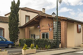 Town hall
 -
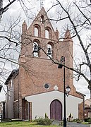 St Peter Church
 -
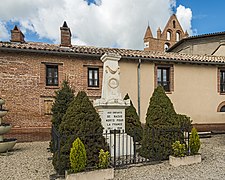 War memorial
 -
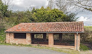 wash hall


See also
References
- ^ "Répertoire national des élus: les maires". data.gouv.fr, Plateforme ouverte des données publiques françaises (in French). 9 August 2021.
- ^ "Populations légales 2021" (in French). The National Institute of Statistics and Economic Studies. 28 December 2023.
Wikimedia Commons has media related to Bazus.
| Authority control databases: National |
|---|
This Haute-Garonne geographical article is a stub. You can help Wikipedia by expanding it. |