Albiac, Haute-Garonne: Difference between revisions
Appearance
Content deleted Content added
No edit summary |
No edit summary |
||
| Line 6: | Line 6: | ||
|department = Haute-Garonne |
|department = Haute-Garonne |
||
|arrondissement = Toulouse |
|arrondissement = Toulouse |
||
|canton = |
|canton = Revel |
||
|INSEE = 31006 |
|INSEE = 31006 |
||
|postal code = 31460 |
|postal code = 31460 |
||
| Line 17: | Line 17: | ||
|elevation max m = 263 |
|elevation max m = 263 |
||
|area km2 = 4.71 |
|area km2 = 4.71 |
||
|population = |
|population = 203 |
||
|population date = |
|population date = 2014 |
||
}} |
}} |
||
Revision as of 14:44, 22 February 2017
Albiac | |
|---|---|
| Coordinates: 43°33′11″N 1°46′53″E / 43.5531°N 1.7814°E | |
| Country | France |
| Region | Occitania |
| Department | Haute-Garonne |
| Arrondissement | Toulouse |
| Canton | Revel |
| Intercommunality | Cœur Lauragais |
| Government | |
| • Mayor (2014-2020) | Gérard Granouillac |
| Area 1 | 4.71 km2 (1.82 sq mi) |
| Population (2014) | 203 |
| • Density | 43/km2 (110/sq mi) |
| Time zone | UTC+01:00 (CET) |
| • Summer (DST) | UTC+02:00 (CEST) |
| INSEE/Postal code | 31006 /31460 |
| Elevation | 175–263 m (574–863 ft) (avg. 230 m or 750 ft) |
| 1 French Land Register data, which excludes lakes, ponds, glaciers > 1 km2 (0.386 sq mi or 247 acres) and river estuaries. | |
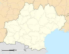
Albiac is a commune in the Haute-Garonne department in southwestern France.
Population
| Year | Pop. | ±% |
|---|---|---|
| 1962 | 94 | — |
| 1968 | 116 | +23.4% |
| 1975 | 117 | +0.9% |
| 1982 | 120 | +2.6% |
| 1990 | 137 | +14.2% |
| 1999 | 159 | +16.1% |
| 2008 | 195 | +22.6% |
See also
References
Wikimedia Commons has media related to Albiac (Haute-Garonne).


