Marsoulas: Difference between revisions
Appearance
Content deleted Content added
Citation bot (talk | contribs) m Add: issue. | You can use this bot yourself. Report bugs here. | User-activated. |
m Added the 10 June 1944 massacre. |
||
| (8 intermediate revisions by 7 users not shown) | |||
| Line 1: | Line 1: | ||
{{Use dmy dates|date=August 2023}} |
|||
{{Infobox French commune |
{{Infobox French commune |
||
|name = Marsoulas |
|name = Marsoulas |
||
|commune status = [[Communes of France|Commune]] |
|commune status = [[Communes of France|Commune]] |
||
|region = Midi-Pyrénées |
|||
|department = Haute-Garonne |
|||
|arrondissement = Saint-Gaudens |
|arrondissement = Saint-Gaudens |
||
|canton = Bagnères-de-Luchon |
|canton = Bagnères-de-Luchon |
||
|INSEE = 31321 |
|INSEE = 31321 |
||
|postal code = 31260 |
|postal code = 31260 |
||
|mayor = Alexandre Ader<ref>{{cite web|title=Répertoire national des élus: les maires|url=https://www.data.gouv.fr/fr/datasets/r/2876a346-d50c-4911-934e-19ee07b0e503|website=data.gouv.fr, Plateforme ouverte des données publiques françaises|date=2 December 2020|language=fr}}</ref> |
|||
|mayor = Alexandre Adler |
|||
|term = |
|term = 2020–2026 |
||
|intercommunality = |
|intercommunality = Cagire Garonne Salat |
||
|coordinates = {{coord|43.1064|0.9994|format=dms|display=inline,title}} |
|coordinates = {{coord|43.1064|0.9994|format=dms|display=inline,title}} |
||
|elevation m = 384 |
|elevation m = 384 |
||
| Line 16: | Line 15: | ||
|elevation max m = 422 |
|elevation max m = 422 |
||
|area km2 = 2.4 |
|area km2 = 2.4 |
||
|population = |
|population = {{France metadata Wikidata|population_total}} |
||
|population date = |
|population date = {{France metadata Wikidata|population_as_of}} |
||
|population footnotes = {{France metadata Wikidata|population_footnotes}} |
|||
}} |
}} |
||
''' |
'''Marsoulas''' is a [[Communes of France|commune]] in the [[Haute-Garonne]] [[Departments of France|department]] in southwestern [[France]]. |
||
It is notable for |
It is notable for the [[Marsoulas Cave]] in which palæolithic artifacts and paintings were discovered.<ref name=Nature>{{cite journal|title=Recent Excavation in the Marsoulas Cave|journal=Nature|date=20 February 1932|volume=129|issue=3251|pages=273–274|doi=10.1038/129273d0|doi-access=free}}</ref> |
||
== History == |
|||
Early in the morning of 10 June 1944, [[Nazi Germany]] invaded Marsoulas, and killed 27 people, 11 being children.<ref>{{Cite web |last=Hanks |first=Jane |date=2021-09-23 |title=The painful SS massacre memories of this tiny French village |url=https://www.connexionfrance.com/magazine/the-painful-ss-massacre-memories-of-this-tiny-french-village/430816 |access-date=2024-04-18 |website=www.connexionfrance.com |language=en-GB}}</ref> |
|||
==Population== |
==Population== |
||
| Line 35: | Line 38: | ||
2008|141 |
2008|141 |
||
}} |
}} |
||
{{clear |
{{clear left}} |
||
==See also== |
==See also== |
||
| Line 41: | Line 44: | ||
==References== |
==References== |
||
*[http://www.insee.fr/en/home/home_page.asp INSEE] |
|||
{{reflist}} |
{{reflist}} |
||
{{commons category}} |
|||
{{commonscat}} |
|||
{{Haute-Garonne communes}} |
{{Haute-Garonne communes}} |
||
{{authority control}} |
|||
[[Category:Communes of Haute-Garonne]] |
[[Category:Communes of Haute-Garonne]] |
||
Latest revision as of 15:44, 18 April 2024
Marsoulas | |
|---|---|
| Coordinates: 43°06′23″N 0°59′58″E / 43.1064°N 0.9994°E | |
| Country | France |
| Region | Occitania |
| Department | Haute-Garonne |
| Arrondissement | Saint-Gaudens |
| Canton | Bagnères-de-Luchon |
| Intercommunality | Cagire Garonne Salat |
| Government | |
| • Mayor (2020–2026) | Alexandre Ader[1] |
| Area 1 | 2.4 km2 (0.9 sq mi) |
| Population (2021)[2] | 136 |
| • Density | 57/km2 (150/sq mi) |
| Time zone | UTC+01:00 (CET) |
| • Summer (DST) | UTC+02:00 (CEST) |
| INSEE/Postal code | 31321 /31260 |
| Elevation | 292–422 m (958–1,385 ft) (avg. 384 m or 1,260 ft) |
| 1 French Land Register data, which excludes lakes, ponds, glaciers > 1 km2 (0.386 sq mi or 247 acres) and river estuaries. | |
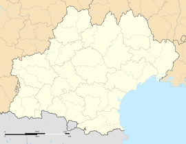
Marsoulas is a commune in the Haute-Garonne department in southwestern France.
It is notable for the Marsoulas Cave in which palæolithic artifacts and paintings were discovered.[3]
History
[edit]Early in the morning of 10 June 1944, Nazi Germany invaded Marsoulas, and killed 27 people, 11 being children.[4]
Population
[edit]| Year | Pop. | ±% |
|---|---|---|
| 1962 | 79 | — |
| 1968 | 114 | +44.3% |
| 1975 | 94 | −17.5% |
| 1982 | 100 | +6.4% |
| 1990 | 112 | +12.0% |
| 1999 | 137 | +22.3% |
| 2008 | 141 | +2.9% |
See also
[edit]References
[edit]- ^ "Répertoire national des élus: les maires". data.gouv.fr, Plateforme ouverte des données publiques françaises (in French). 2 December 2020.
- ^ "Populations légales 2021" (in French). The National Institute of Statistics and Economic Studies. 28 December 2023.
- ^ "Recent Excavation in the Marsoulas Cave". Nature. 129 (3251): 273–274. 20 February 1932. doi:10.1038/129273d0.
- ^ Hanks, Jane (23 September 2021). "The painful SS massacre memories of this tiny French village". www.connexionfrance.com. Retrieved 18 April 2024.
Wikimedia Commons has media related to Marsoulas.


