|
Notice
We are pleased to acknowledge that some maps in this
collection were adapted from originals at
Atlas of the Orient made by
Tore Kjeilen
Detail and Historical Maps of the Middle East
Israel Disengagement Map- 2005
Israel Security Fence (Apartheid Wall) - UPDATED February 2005
Israel Security Fence (Apartheid Wall) - UPDATED April 2006
Map of Gaza
Detailed Map of Israel
Map of Israel
Map of Palestine
Israel/Palestine Historic maps
Map of Palestine - "Land of Israel" 1845
Borders of Palestine Mandate Proposed by Zionist Organization, 1919
Jerusalem
Detail Map
Jerusalem/Quds to Jericho
Map of UNSCOP Partition
Plan for Palestine - 1947
UN Palestine Partition Plan Map
- 1947
Map of Arab Invasion, 1948
Map of Jerusalem - UN
'Corpus Separatum' and Divided Jerusalem
Detailed Map of Palestine 1949 (Overview)-with draft of Armistice Lines
Northern Detail 1949 (~1 MB)
Central Detail 1949 (~1 MB)
Southern Detail 1949 (~1 MB)
Map of 1949 Israel
Armistice Lines - The Green Line
Syrian Israeli Armistice of 1949 - borders and detailed map.
Territory Occupied
by Israel in the 6 Day War
Alon Plan Map of the West Bank - 1967
October War (Yom Kippur War) - Egyptian front
October War (Yom Kippur War) - Syrian front
Maps of Israeli-Palestinian Final Settlement Negotiations in 2000 and 2001 (Camp David,
Washington and Taba)
Map of Israel
and Palestinian territories following Oslo II
Israeli West
Bank Settlements-2002
West
Bank Water Resources
Planned Israeli
Security Fence - 2002
Israeli Security Fence Update - Spring 2003
Swiss Accords (Beilin Abd-Rabbo Document) Maps
Palestinian Refugee Camps
Detailed Road Map of
Israel
(at Zionism and Israel Information Center)
Maps
of Israel showing distances to borders and comparative size
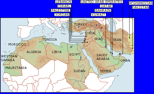
Iraq - Detailed Map
Iraq-Religious/Ethnographic
Map
Baghdad - Overview
Major Streets
of Baghdad Lebanon
Map of Lebanon (Overview)
Map of Lebanon Detailed
Map of Southern Lebanon - Detailed (Large 1.8
MB)
Map of Northern Lebanon -
Detailed (Large 1.2 MB)
Map of Lebanon - Detailed - (VERY LARGE -3.7MB
Beirut Map
Maps of Israel (off site)
Map of Canaan (Israel in the time of Joshua (Black and
White)
Map of ancient Canaan (Palestine) after the
Conquest by the Israelites
Palestine (Israel, Canaan) in the Time of the Judges
Map of Israel (Canaan) in the reigns of
Kings David and Solomon (Black and White)
Map of Judah (Judea) in the Maccabean Kingdom of Alexander Janeus (Yannai)
Map of Israel: Detailed Roadmap of Israel and the occupied territories
Maps of Israel showing distances to borders and comparative size
Map of Jewish Settlement in Israel (Palestine) 700 -1099 (Arab rule) Jerusalem Map Map of Jerusalem Ancient map of Jerusalem
Map of Palestine - Land of Israel, 1845
Map of Jerusalem drawn about 1200
Map of Jerusalem - World with Jerusalem at the Center - 1581
Map of Jerusalem - Cook's Tours Map of Jerusalem 1924
Map of Israeli Conquest of Jerusalem, June 5-7, 1967
The 2006 Lebanon War
Map of Hezbollah Rocket Attacks - July 2006
Map of Israeli Operations in South Lebanon - July 2006
Map of areas bombed in Beirut to July 21, 2006
Yom Kippur War
Egyptian Front- Map of Stage I of the Yom Kippur War in Sinai
Egyptian Front
Map - Overview of the Yom Kippur War in Sinai
Egyptian Front- Map of Stage II of the Yom Kippur War in Sinai
Map of Yom Kippur War
Syrian Front Initial Phase
Map of Yom Kippur War
Syrian Front Final Phase
Yom Kippur War Overview Map of Syrian Front
Security Fence
Map of
Israel Security Fence/Barrier According to IDF (2006)
Map of Israel Security Fence/Barrier According to Betselem (2006)
Israel Security Fence - Detail Map - Northern Section
Israel Security Fence - Detail
Map - Qalqilia Section
Israel Security Fence - Detail Map - Jerusalem Section
Israel Security Fence - Detail Map -
Southern Section
Map of Hezbollah Rocket Attacks - July 2006
External site:World Maps
- Maps of the World including Middle East
|