

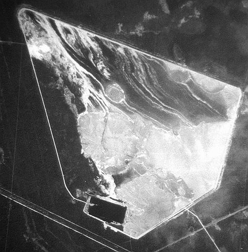
Angarsk
Electrolyzing Chemical Combine (AEKhK)
N 52°28' E103°52'
The Angarsk Electrolyzing and Chemical Combine (AEKhK) was established in the late 1950s to produce enriched uranium for the Soviet nuclear program. The gaseous diffusion plant in Angarsk attained its full capacity in 1964 and, at the time, was believed to be the most efficient of the existing Soviet enrichment facilities.
The enrichment plant in Angarsk has never produced HEU. Instead, its partially enriched uranium product was probably sent to other Soviet enrichment facilities to produce HEU. At present, the Combine accounts for 8 percent of Russia's enrichment capacity.
In addition, the complex operates one of Russia's two large conversion facilities producing UF6, the feed material for enrichment facilities. Uranium hexafluoride production technology began to be developed in the USSR in 1947. The first, relatively ineffective, fluorination processes involved uranium oxide dissolution in sulfuric acid, electrolytic uranium sulfate reduction, and hydrofluorination. In 1965, the technology of fluorination in a vertical plasma reactor was created and is still in use today. Conversional plants in Russia are located at the same sites as uranium concentration mills: in Sverdlovsk-44 / Novouralsk (close to Yekaterinburg) and Angarsk. The productivity of conversion enterprises matches that of concentration mills, and the uranium enrichment on average is 2.18%. Uranium hexafluoride is then transported to concentration mills located at Tomsk, Krasnoyarsk, Angarsk, and Sverdlovsk-44.
The facility is located in the open city of Angarsk, approximately 30 km north-west of Irkutsk and 50 km north of the western tip of Lake Baikal.
Regional Context
Located in the middle of the Asian part of Russia, Irkutsk region stretches 1,400 kilometers from north to south, 1,200 kilometers from west to east, and covers 774,800 square kilometers. The region is bordered by Krasnoyarsk territory, Chita region, the republic of Sakha (Yakutiya), the autonomous republic of Tuva, and the Buryat republic. The region is comprised of the Ust-Orda Buryat autonomous area and 33 districts. About 86 percent of the region is forested and timber resources are estimated at more than 8 billion cubic meters. The climate is continental, with extreme winter and summer temperatures.
The population of Irkutsk region is 2.8 million (about 2 percent of russia's total population), with major centers in Irkutsk (587,000), Angarsk (272,000), Bratsk (283,000), and Usolye Sibirskoye (195,500). Four other towns (Ust-Ilimsk, Cheremkovo, Ust-Kut, and Tulun) have populations between 50,000 and 100,000. Overall population density is 3.7 persons per square kilometer, compared to 8.7 in Russia as a whole. The social and political situation of the region is considered to be among the most stable in Russia.
At the beginning of the century much of the region's development was connected with construction of the trans-siberian railroad, which crosses the southern part of the region, and the "taishet-baikal-amur railway" branch line, which crosses the region's northern districts. The trans-siberian railroad remains the most important transportation network in the region and annually services more than 57 million tons of freight, mostly timber, coal, oil products, ferrous and nonferrous metals, and construction materials.
The chemical industry accounts for roughly one-third of Irkutsk's industrial output. Pipelines bring oil from Western Siberia to the Angarsk Oil Refinery, the largest fuel supplier in Eastern Russia. Oil is also shipped via rail from Angarsk to refineries in Khabarovsk and Komsomolsk-on-Amur. There are more than 1,550 industrial enterprises operating in Irkutsk region. The combination of rich natural resources, a strong power complex providing cheap electricity, a diversified industrial structure with a well- developed processing sector, and a good transportation system have been vital ingredients to the development of the region.
Imagery Evaluation Report
As of 07 October 2000 the Space Imaging Carterra Archive had one image of this area, which was quite nice.


Sources and Methods
- Thomas Cochrane, William Arkin, Robert Norris and Jeffrey Sands, Soviet Nuclear Weapons Nuclear Weapons Databook Volume IV, Natural Resources Defense Council [New York, Harper & Row, 1989].
- Thomas Cochrane, Robert Norris and Oleg Bukharin, Making the Bomb - From Stalin to Yeltsin [Boulder, Westview Press, 1995]
- Nuclear Fuel Cycle in the Former USSR and in Russia: Structure, Possibilities, Prospects by Oleg Bukharin [Association for the Support of Nonproliferation], Moscow] 1993
- Angarsk Electrolyzing Chemical Combine (AEKhK) 2000/02/19 2000021903490470000011620063
|
NEWSLETTER
|
| Join the GlobalSecurity.org mailing list |
|
|
|