

Navy Bases
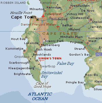 The Navy has its main naval base and dockyard at Simon's Town near Cape Town, and a naval station with basic dockyard facilities at Durban. It has a training centre at Saldanha Bay to the northwest of Cape Town. There are reserve bases in Cape Town, Durban, East London and Port Elizabeth, as well as at Simon's Town and in Johannesburg and Pretoria.
The first British occupation in 1795 was effected from Simon's Town under the following circumstances. At that period the Cape of Good Hope belonged to Holland, or, rather, to the Dutch East India Company, and the British Governnient had arranged with the Dutch authorities for the occupation of the place by British troops, in order to checkmate the scheme of French aggrandisement in those regions. Accordingly, a fleet commanded by Admiral Elphinstone, with General Craig in charge of the troops on board, was despatched thither; but owing to a genuine mis-understanding, or out of sheer perversity, the Dutch East India Companys oflicials declined to permit the British troops to land; with the result that General Craig forced a landing under cover of the fire from the fleet.
Subsequently Simon's Town became the headquarters of the Cape and West Coast Naval Squadron. Eventually extensive dockyard accommodation, extending for nearly a mile along the shore, was erected, together with all appliances necessary for refitting and repairing the vessels on the station. In view of the increasing importance of Britian's South African possessions, it was decided to convert the place into a first-class station for the Imperial Navy, with graviig docks to take any ship afloat. In November 1900, this important project crystallised, and the firm of Sir ]ohn Jackson, Limited, obtained the contract for the construction of what was practically a new Naval port at Siinons Bay, the Parliamentary estimate of the cost of which was put at £2,500,000.
Cape Town competes with Alexandria for recognition as the most famous port in Africa and is certainly one of the most beautiful harbors in the world with its magnificent backdrop of Table Mountain. The port is situated on one of the world's busiest trade routes and will always retain strategic and economic importance for that reason alone. The port is located in Table Bay at Latitude 33° 54' S and Longitude 18° 26' E and lies 120 nm northwest of Cape Agulhas (the most southerly point in Africa).
The historic Victoria and Alfred Basins - the original Cape Town harbor - now house the world famous Cape Town Waterfront but remain in use for commercial purposes, creating a unique attraction for the waterfront development. These are used by smaller commercial vessels including fishing and pleasure boats and by smaller passenger cruise ships. U.S. Navy vessels also typically berth in these basins.
The port of Cape Town remains open 24 hours a day 7 days a week. The depth at the entrance channel is -15.9 m Chart datum, and is -15.4 m at the 180 m wide entrance into Duncan Dock and -15.5 m at the entrance to Ben Schoeman Dock. The depth in the Duncan Dock varies between -9.9 m near the repair quay to -12.4 m at the tanker basin. Recently, the Main Quay of Ben Schoeman Dock was dredged to 15.5 m. However, the final survey had not been completed as of September, 2009. This will provide for deeper berths for the new generation of container shipping and could also allow for U.S. Navy aircraft carriers to dock at the Main Quay.
The port boasts extensive ship repair facilities. The port has evolved greatly over the centuries and currently consists of several main components:
- The Ben Schoeman Dock: This is the large outer dock of the port, where the container terminal is situated. Maximum size of vessel handled: length 370m, width 87 m. The Main Quay is in the process of being reinforced (as of September, 2009) and hard rubber fendering is being placed throughout the Main Quay (see Photos 3 ,14 and 15.)
- The Duncan Dock: This is the smaller and the older inner dock, containing the multi-purpose and fruit terminals as well as a dry dock, repair quay and tanker basin.
- The Yachting Marina.
- The Victoria and Alfred Basins: These were the main piers of the original Cape Town harbor, but now house the Victoria and Alfred Waterfront. However, these basins are still used by smaller commercial vessels such as fishing and pleasure boats and also by smaller passenger cruise ships. U.S. Navy vessels also typically berth in these basins.
Oil tankers and vessels carrying hazardous cargo or explosives are prohibited from berthing at night. The U. S. Navy typically uses Jetty No. 2 of the Victoria and Alfred Basins for berthing. Pilots indicate bow in is safer for vessels at V and A. The U. S. Navy has also used the Eastern Moles (Berths 1 and 2) of Duncan Dock for berthing. CV 71 in October, 2008 anchored out in about 25 m depth with a shell/rock bottom with good holding and put out 6 shots in 9 ft + seas.
Table Bay provides anchorage in convenient depths in the authorized anchorage areas and clear of the disused cable area extending from a point on the shore 0.7 miles N of Milnerton Light. Vessels anchoring in Table Bay must do so in one of the designated anchorages which are numbered and indicated as follows (with positions relative to the castle (33 degrees 55 minutes .6S, 18 degrees 25 minutes .6E))
- No. 1 general, summer only - 3.5 miles NW (rocks and sand)
- No. 2 general - 4 miles NNE (sand, mud and rock)
- No. 3 small vessels - 2.75 miles NE (sand)
- No. 4. hazardous - 6 miles N (sand and mud)
Vessels at anchor in the bay should at all times keep their main engines ready at short notice, and be prepared to put to sea on the approach of winter gales. For the rest of the year, and particularly during the months of December, January and February, SE winds, which may reach gale force, are to be expected, and vessels are advised to anchor as far to the E as their drafts would comfortably allow. Vessels are cautioned against anchoring or trawling in the disused dumping area, W of Table Bay, where hulks of explosives exist.
|
NEWSLETTER
|
| Join the GlobalSecurity.org mailing list |
|
|
|